Advanced Remote Sensing
Image Object Feature Segmentation for Classification
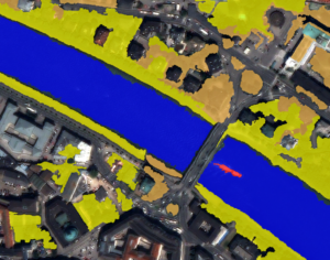
Using eCognition, a quickbird image is segmented based on several spectral and spatial characteristics.
Using eCognition, a quickbird image is segmented based on several spectral and spatial characteristics.
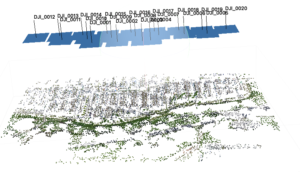
In this Assignment, a workflow is followed that creates a dense point cloud, Orthoimage and DEM from UAV data in Munich, Germany.
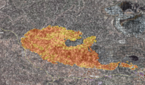
In this exercise for the Advanced Remote Sensing class, a tutorial on how to extract a burnt area from Sentinel-1 imagery was performed.